GIS Mapping
Structured GIS datasets and mapping systems for planning, utilities, and decisions.
MapSphere builds authoritative GIS datasets and mapping systems that help government bodies, utilities, and enterprises visualize, analyze, and manage spatial information as a single source of truth.
We deliver municipal, utility, cadastral, transport, and infrastructure GIS — from data conversion and digitization to spatial analysis and topology-validated geodatabases.
Key deliverables
Scope of work
- Municipal Corporation GIS Projects
- Utility & Asset Mapping
- Town Planning & Master Plan Mapping
- Road, Highway & Railway GIS Mapping
- Land Parcel & Cadastral Mapping
- Water Supply & Drainage Mapping
- Power & Telecom Network Mapping
- Urban Infrastructure Planning & Mapping
- Disaster Management GIS
- Mining & Quarry GIS Mapping
What you receive
- GIS layers
- Geodatabases
- Shapefiles
- GeoJSON
- Utility maps
- Cadastral layers
- Attribute databases
- Topology-validated datasets
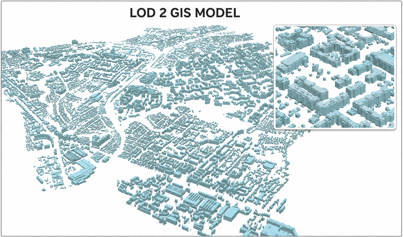
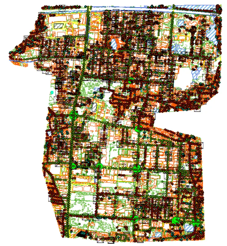
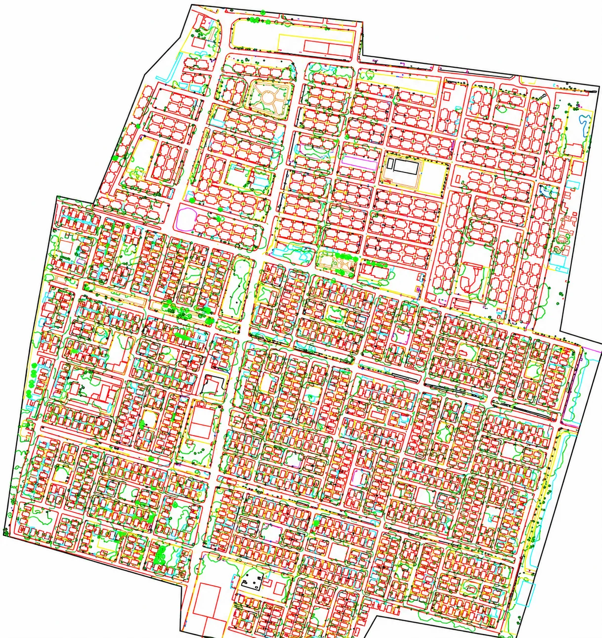
Sample outputs
Where it’s used
How we deliver it
Project Scope
Understand site, objective, deliverables, timeline, and accuracy needs.
Survey Planning
Select the right method — UAV, DGPS, Total Station, LiDAR, GPR, Bathymetry, or hybrid.
Data Capture
Collect field, aerial, scan, image, and control data with approved instruments and trained teams.
Processing & Modeling
Convert raw data into GIS, CAD, BIM, orthophotos, point clouds, DTM/DSM/DEM, and maps.
Quality Validation
Validate accuracy, topology, alignment, coordinate system, completeness, and standards.
Final Delivery
Deliver maps, drawings, reports, spatial databases, models, and decision-ready outputs.
Related services


GIS Mapping — common questions
01What GIS deliverables do you produce?
Topology-validated geodatabases, shapefiles and GeoJSON, utility and cadastral layers, attribute databases, and thematic maps — built to OGC standards with ISO 19115 metadata so the data is interoperable and auditable.
02Do you handle municipal and utility GIS at city scale?
Yes. We build municipal corporation GIS, utility/asset networks, cadastral and land-parcel layers, and town-planning datasets that act as a single source of truth across departments.
03Which coordinate systems do you support?
Global (WGS 84, Web Mercator), India UTM zones 43N–46N (EPSG:32643–32646), and any client-specified or local engineering grid. We document the CRS in the deliverable metadata.
Start your GIS Mapping project
Share your site and objectives — we’ll scope the right approach and timeline.