
Urban Planning & Municipal GIS
Authoritative base mapping and GIS systems for municipalities and town planning.
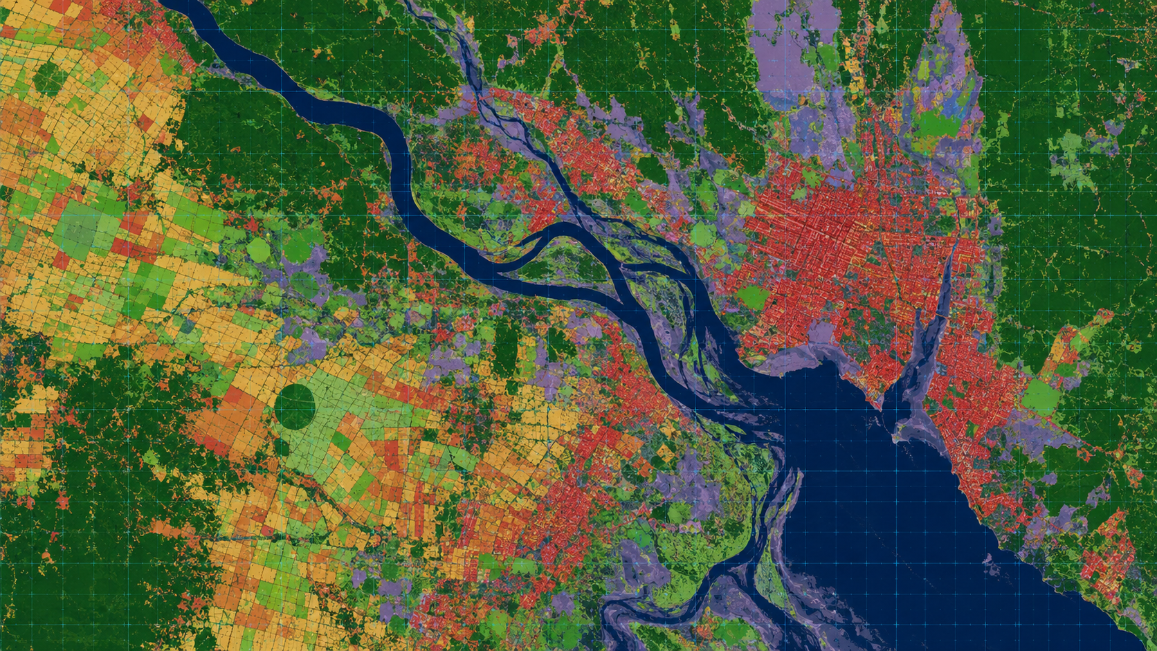
Municipalities and planning authorities need an authoritative, current spatial base. MapSphere builds municipal GIS, parcel and cadastral layers, and base maps from drone ortho, satellite imagery, and field survey.
Our data underpins master planning, land records, revenue, and asset inventories.
Relevant services
Use cases
What this sector demands
Outdated base maps
Fresh drone and satellite capture replace decades-old records with current, accurate base mapping.
Parcel accuracy
Cadastral and parcel layers need careful capture and topology validation for land-records use.
Cross-department use
One standards-compliant dataset must serve planning, revenue, utilities, and works.
What you receive
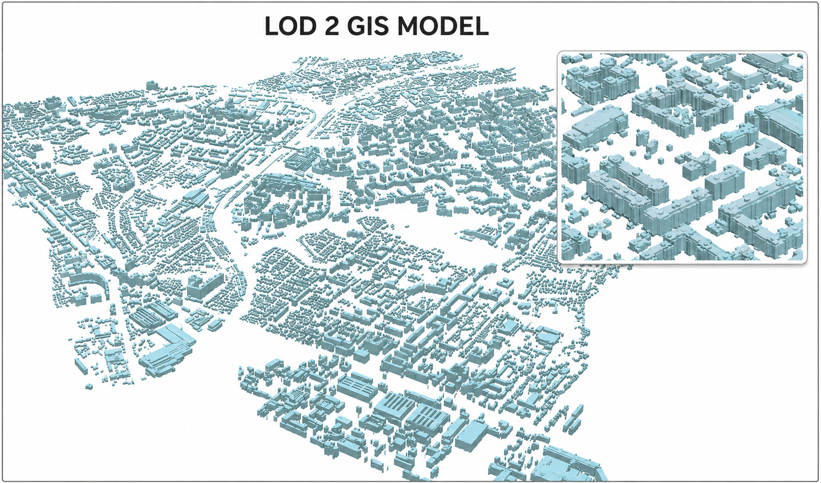
- Municipal GIS
- Base maps
- Parcel layers
- Thematic maps
How we deliver it
We produce orthophoto base maps, digitize and validate parcel/cadastral and thematic layers, and deliver a topology-clean municipal geodatabase.
Deliverables include municipal GIS, base maps, parcel layers, and thematic maps to OGC standards with ISO 19115 metadata.
Services we apply here


Urban Planning & Municipal GIS — common questions
01What does a municipal GIS include?
A current orthophoto base map, parcel/cadastral layers, thematic and infrastructure layers, and a topology-validated geodatabase — built to OGC standards with metadata for cross-department use.
02How do you create the base map?
From drone orthophotos (1–5 cm GSD) and/or satellite imagery, orthorectified and georeferenced, supplemented with field verification.
03Can the GIS support land records and revenue?
Yes. Validated parcel/cadastral layers with reliable attributes support land records, revenue, and planning workflows.
Planning a urban planning & municipal gis project?
Tell us about your site and objectives — we'll scope the right survey approach, accuracy, and deliverables.